Mudejar landscape. Dynamics, processes and strategies.
Paisaje Mudéjaris a project that investigates the relationship between landscape and historical heritage, the trace of human intervention that transforms the landscape in the localities of the Rambla del Ribota. Through a series of cartographic analyses , the result of travelling around the towns and developing their photogrammetric models, the fundamental landscape elements and phenomena are identified. Based on this study, a guide and propositive cartographies are drawn up with the aim of improving the landscape at different scales and time phases, following the contemporary theories of landscape architecture.
Historical heritage is one of the most valuable treasures of a society. It represents the history, traditions and culture of a region or country. However, the fundamental role that landscape can play in the conservation and enhancement of this heritage is often overlooked. It is a key element in the perception of historic heritage and can significantly enhance people’s understanding and enjoyment of it.
This paper aims to collect several contemporary landscape theories together with the analysis plans and apply them to the three populations under investigation.
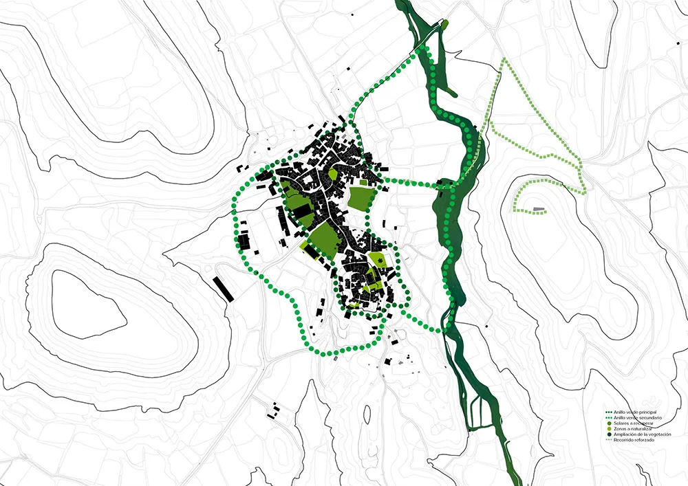
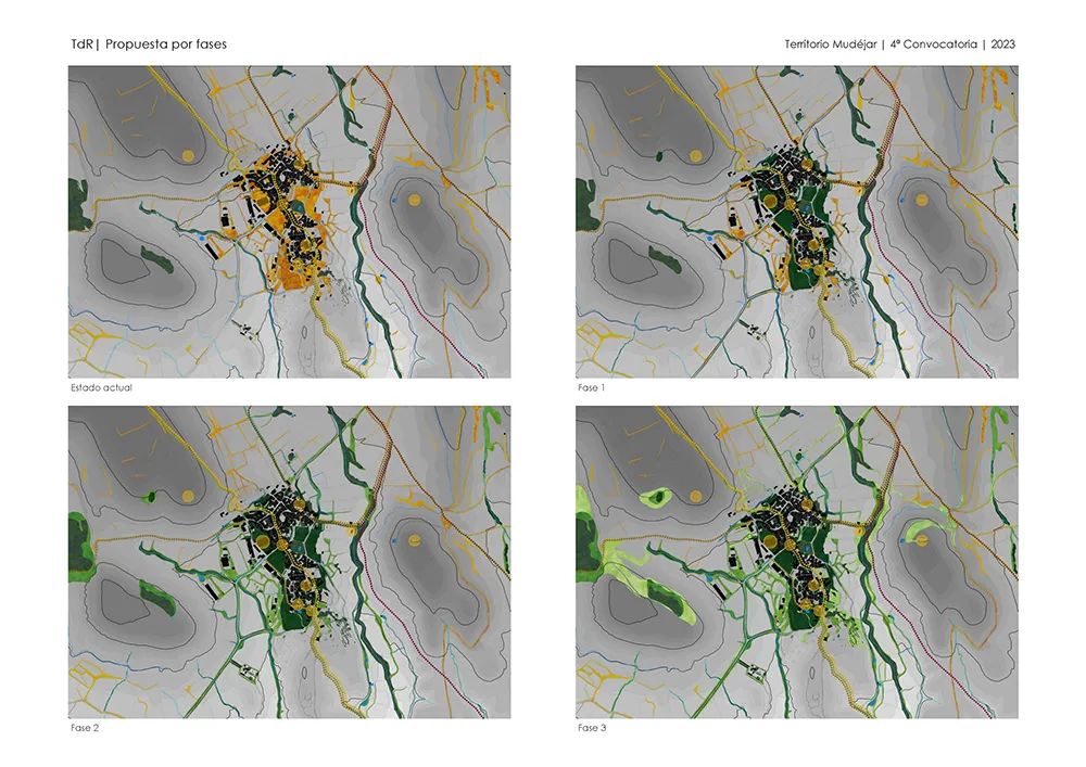
The set of measures proposed understand the landscape as a key resource for the conservation and enhancement of the historical heritage. They have been designed taking into account that they can represent opportunities for the development of the territory and that their implementation requires a moderate investment.
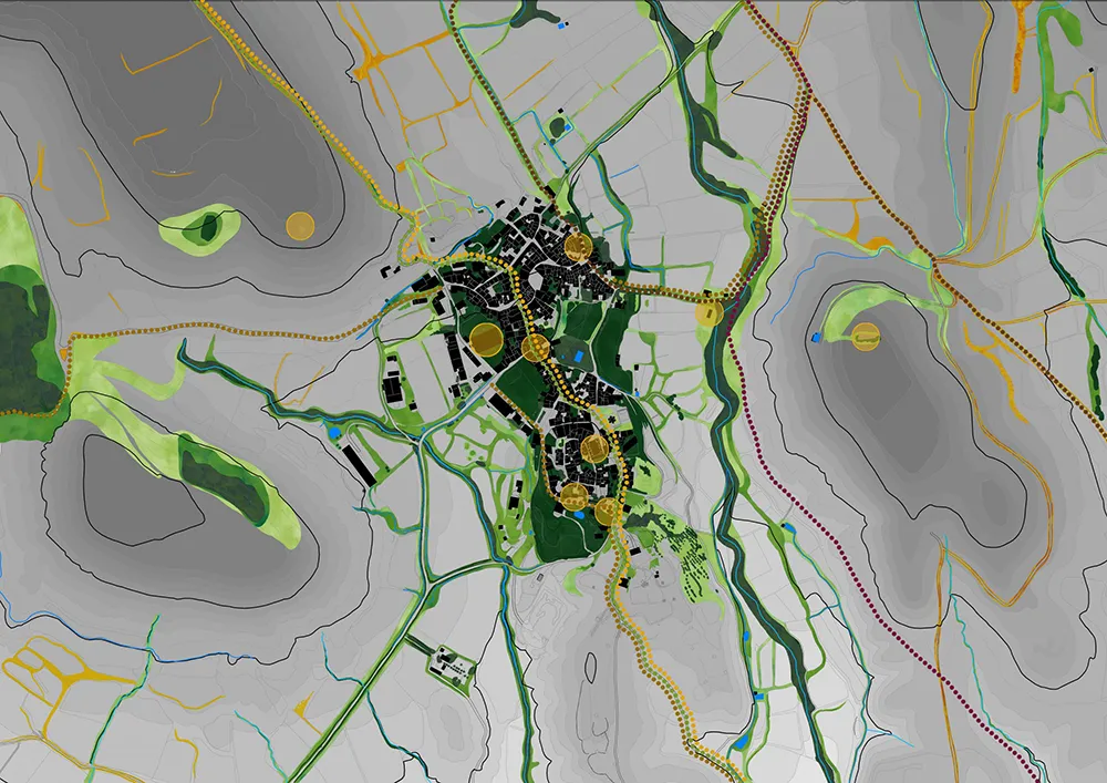
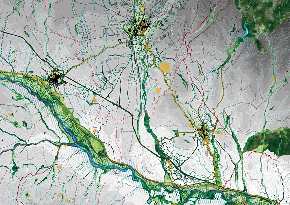
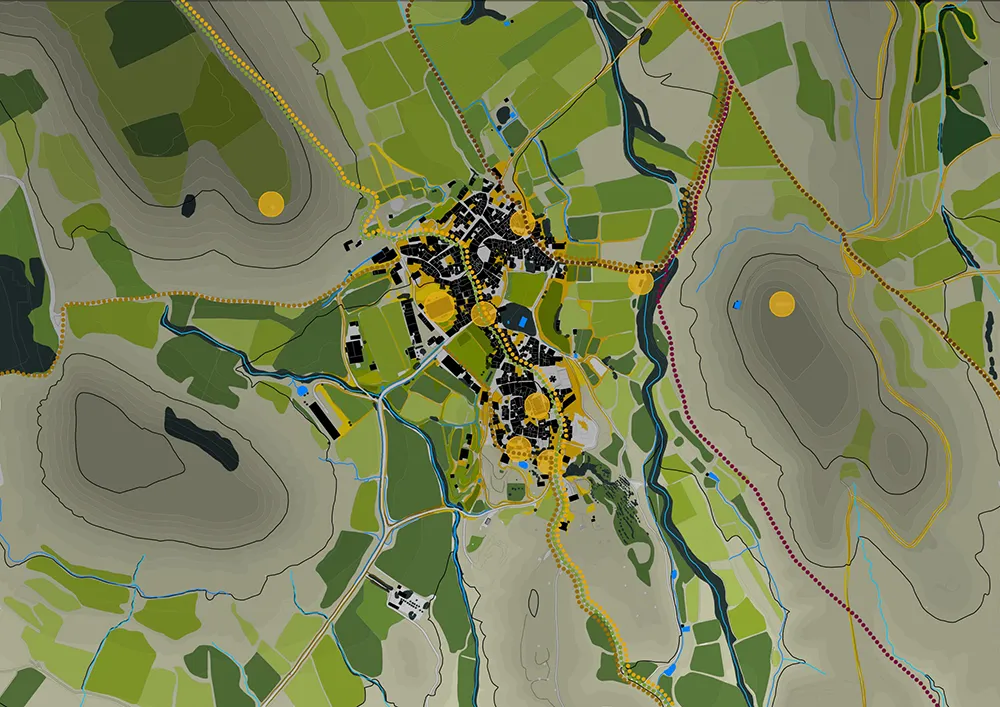
The main idea and guiding thread of these strategies is to create a landscape fabric that connects the villages around the natural landscape and the existing historical heritage, conserving and reinforcing the forests and vegetation of the area by relying on its natural and artificial watercourses.
- The most effective way of weaving the green structure is born in the most powerful element of the landscape: the river Ribota as a space to reinforce and extend the riverside vegetation and to extend the greenway along the old railway line as a great biological corridor.
- Connecting localities through the topography of the area which, with the exception of some small hills, descends into the valley through ravines, irrigation channels and streams.
- Use the concept of Third Landscape: reinforce the landscape character of boundaries, unused plots or abandoned infrastructures, which are often places of native vegetation reserves, rich in biodiversity and markers of uniqueness.
LINE OF RESEARCH: New perspectives on Mudejar art.
AUTHORS: Javier Montori. Esteban Lahoz